As places to live, places to grow food, to have fun, sources of power, places to build things, and as ways of getting around, river systems play vital and varied roles. Throughout history, rivers have played a key part in the formation of major cities across the world.
Since 2014, we’ve been researching the changing roles of Scotland’s greatest river. Our ‘Discovering the Clyde’ research programme has explored the relationship people have had with the River Clyde through time.
We’ve made the results from each of the projects available in Canmore, our online database for the National Record of the Historic Environment. As the programme draws to a close, we highlight some of the key projects we’ve undertaken.
Connected with the Clyde
Back in 2014/15, we kicked off the programme with the ‘Connected with the Clyde’ project. It was important to assess the quality of the records we already had about the Clyde, before embarking on our new research.
We found lots of evidence of how people have used the river, from Watermeetings near the source, right down to Greenock and Helensburgh. From mills to harbours, and from crannogs to pill boxes, we were able to improve over 350 Canmore records with Clyde ‘connections’.
As well as updating existing records, we also added over 300 new sites. Our fieldwork will benefit future research projects, ensuring that these records can be used with confidence.
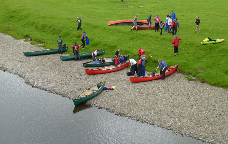
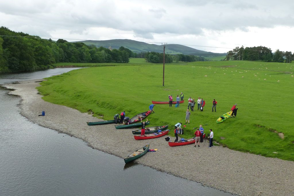
Fieldwork for ‘Connected with the Clyde’ included a canoe trip down part of the river, where less accessible sites were visited.
Yard by Yard
The Clyde is also world-famous for its shipbuilding legacy. However, there was a lack of evidence of this period among our records. With help from the Inverclyde Community Development Trust, we’ve been investigating the shipyards and related sites in Greenock and Port Glasgow.
As well as improving on existing records for the yards, we’ve been creating ‘polygons’ of them. These are shapes that show the extent of the yards at various points in time. This helps tell the story of the changing face of the waterfront from the 19th century to the present day.
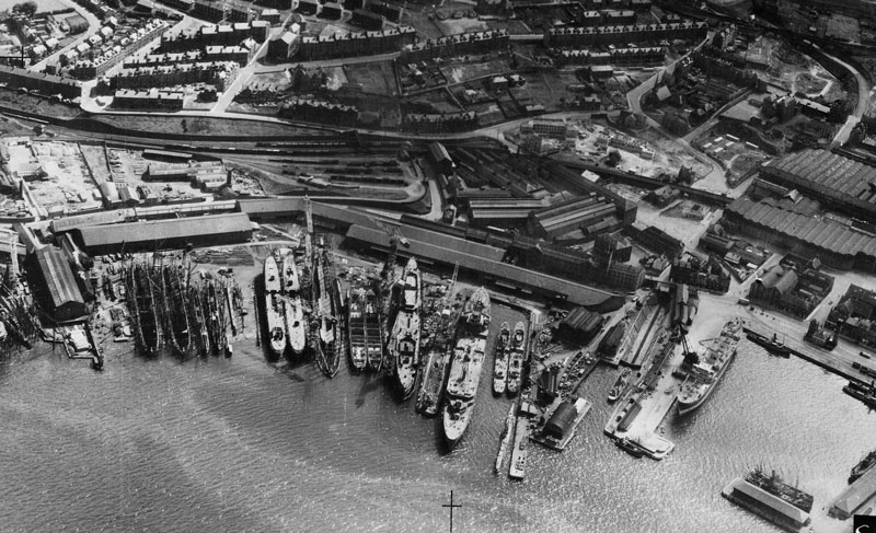
Scott’s Shipbuilding Yard, Greenock, in July 1940. SC1392061.
Clydebuilt
The ‘Clydebuilt’ project was a study by Cotswold Archaeology. It looked at the surviving shipwreck heritage of Clyde-built vessels lost within the Clyde estuary and Firth of Clyde. These reflect both the river’s unique contributions to world-wide shipbuilding and its local connections.
Recreational divers were invaluable in offering sources of information about the current condition of many Clyde-built wrecks. This is extremely useful for on-going management.
Throughout Clydebuilt, we were able to positively identify a number of wrecks previously lacking identity within the National Record of the Historic Environment database.
We were also able to add more accurate positional information for a number of other wrecks. Additionally, this project helped uncover a potentially significant wreck – that of the 19th century Clyde Puffer Margaret Niven – which sank in 1908 and the remains of which were previously unrecorded.
The wrecks include other Clyde Puffers, as well as the paddle steamers Lapwing and Princess of Wales. There were steam-yachts with military connections such as HMS Breda. There were also wrecks of a dredger – the Greenock – and an 18th-century West Indiaman – the ‘Lady Margaret’.
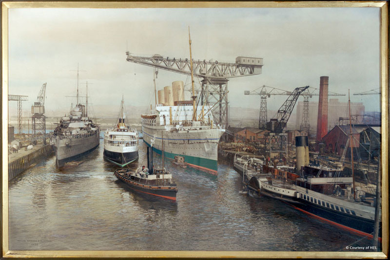
A painting of Fairfield’s fitting-out basin, 1930. SC560036.
Defending the Clyde
The Clyde has been strategically important for centuries. We can see this in the rich landscape of prehistoric and Roman forts, medieval castles and country estates.
We less often think of the Clyde as a place of power in the 20th century. However, this was a period that saw the building of extensive military defences along the Firth of Clyde. This was to protect the major manufacturing and population centres along the river during the First and Second World Wars.
Joining forces with Glasgow University’s Centre for Battlefield Archaeology, as well as local heritage groups, ‘Defending the Clyde’ allowed us to research defences built to protect from both sea and air attacks.
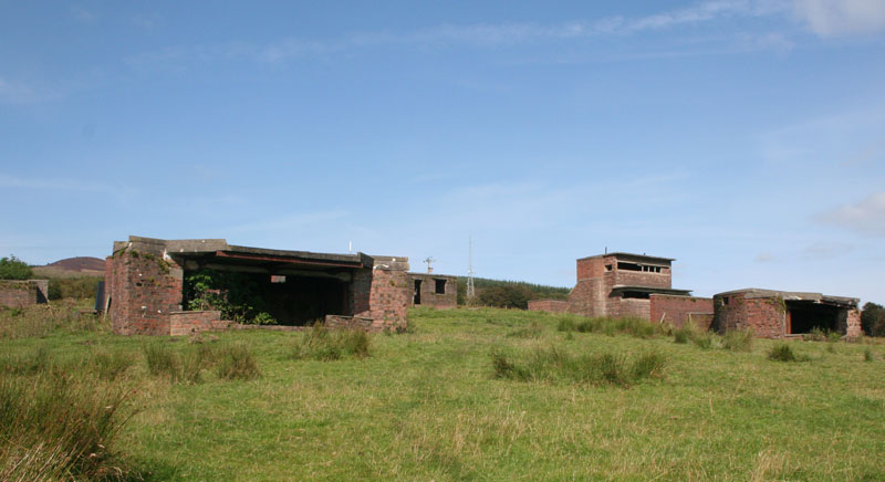
Second World War remains of Toward Battery, which helped protect the Clyde Estuary from naval attack. DP247229.
However, these sites were almost undocumented, and no excavation had ever been undertaken. The majority of them had no site record, or at best a very basic one, and none of the structures were listed or scheduled.
Our investigations have given local people a better understanding of the importance of the sites. We hope this will lead to better-informed decision-making about their future.
You can find out more about our recent research into the Clyde’s coastal defences here!
Our Outputs
The ‘Discovering the Clyde’ programme has improved understanding of how humans have affected, and been changed, by the River Clyde.
Our projects have examined some aspects of the river from its source to the sea. We’ve been inviting the public to discover new ways of looking at the river, producing new ideas about the heritage of this amazing 110 mile thread of history.