Did you know we have one of the largest collections of historical aerial photographs in the world?
NCAP is the National Collection of Aerial Photography and holds over 26 million aerial photographs featuring events and places around the world, from the Dambusters and D-Day to the Cold War. We secure the future of these records, both digital and physical, preserve them for generations to come, and make them accessible through our website and search room.
Aerial photographs from NCAP are used to detect unexploded Second World War bombs in Britain, Germany and other countries. They also help people analysing land use change and resolving boundary disputes.
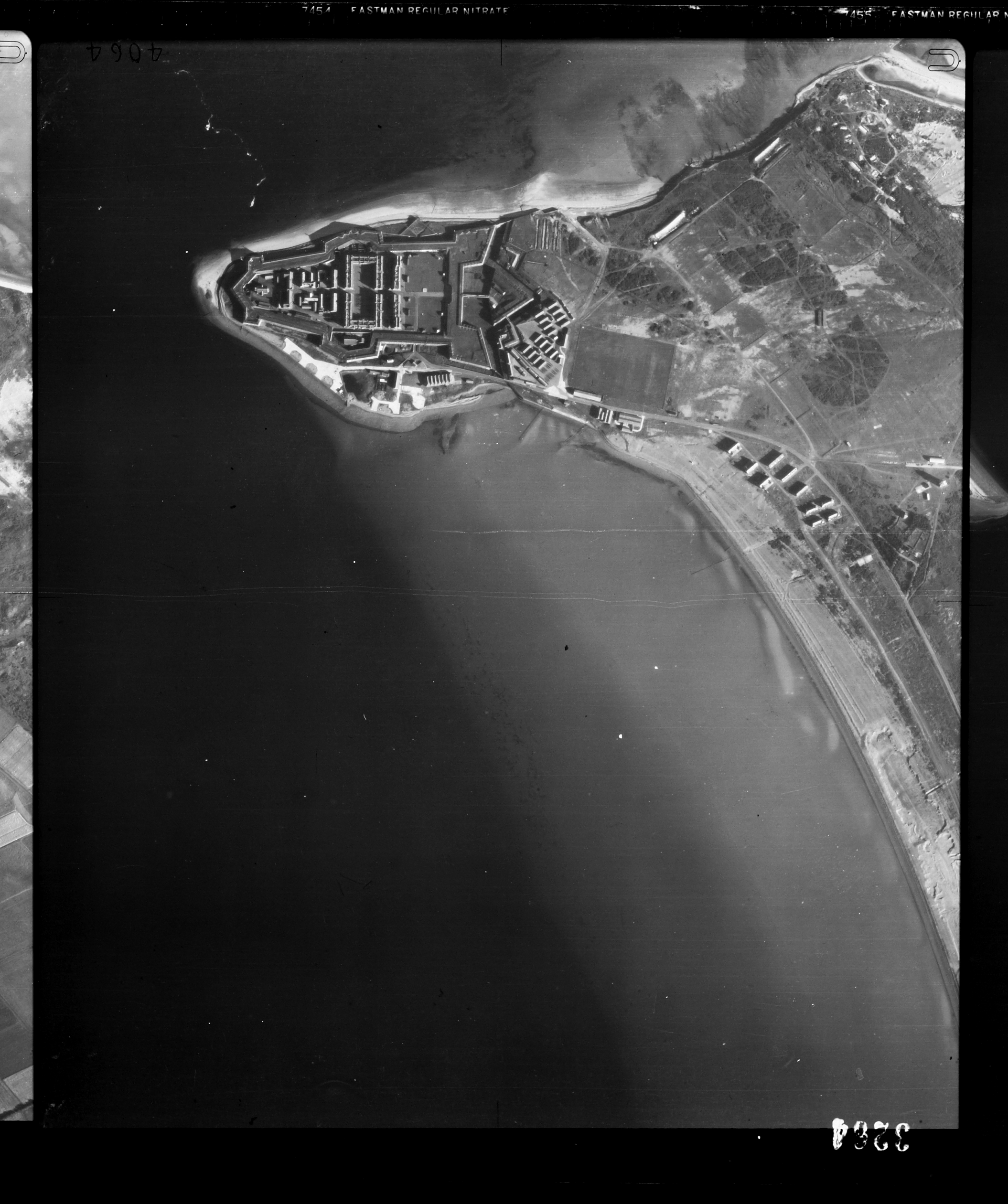
Aerial photograph of Fort George, taken in 1946. Fort George has been in continual use by the British Army since the 18th century and served as a base depot during the First and Second World Wars.
Ordnance Survey Project
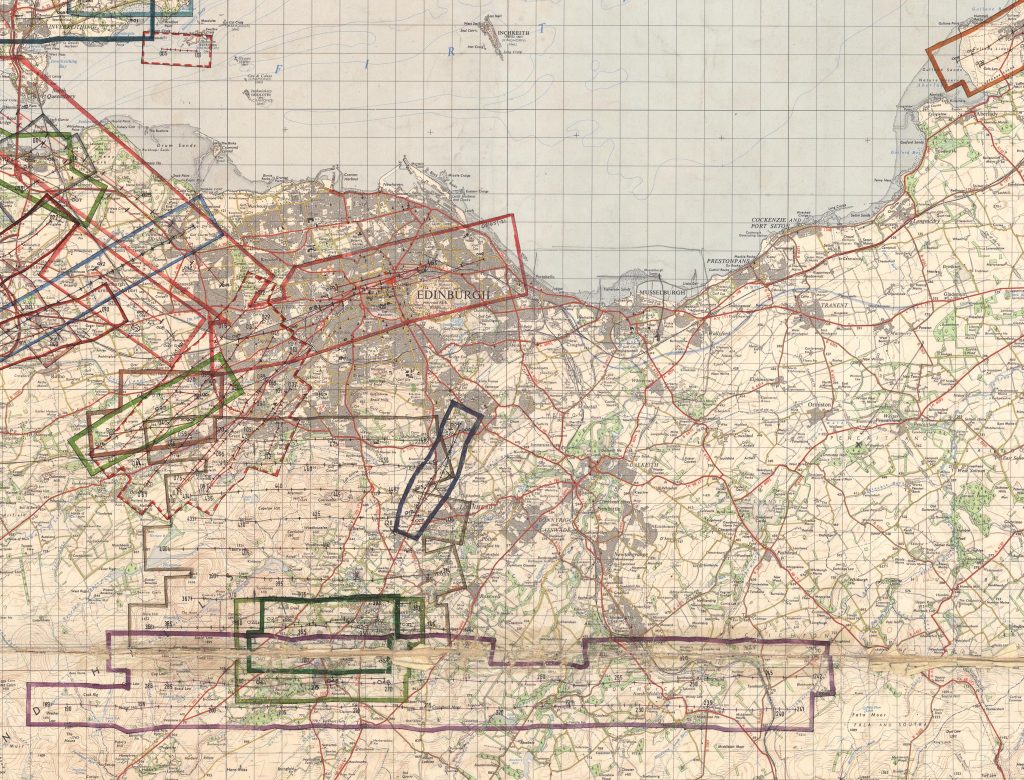
NCAP also holds aerial photography covering every inch of Scotland. These photographs were mostly taken by the Royal Air Force and Ordnance Survey from 1944 to 2009. After each survey flight, the ground photographed was drawn onto a series of maps. These maps are the Finding Aids that allow us to identify aerial photography of specific places.
Since 2008, my colleagues have been digitising and uploading these maps to our website. This work was completed recently, when the final 393 Ordnance Survey Finding Aids were uploaded.
I joined in 2015 and worked on the most recent batch, which has just been completed. Over the past year I edited thousands of features and rectified hundreds of maps to make this last remaining piece of the Scottish jigsaw publicly available. Thanks to this work, we can now offer a virtual search room to the public. This new digital public service opens up access to over a million not-yet-digitised aerial photographs of Scotland.
Using the virtual search room
You can now search for aerial photography by geography, sortie reference or Finding Aid number. Once you have identified the photographs covering your area of interest from the Finding Aid, you can order high resolution scans of them, choosing from one of our many digitisation services. See our video guide to using the Finding Aids:
Luckily, I love maps, I’ll happily spend hour’s georeferencing, plotting flight paths and squinting at Finding Aids to work out where on earth Dull and Lost are (Perthshire and Aberdeenshire, if you’re interested). I have certainly expanded my knowledge of Scottish geography!
Finding Aids showing remote areas in the Highlands and Islands, with their evocative place names, caught my interest over those of the familiar towns and cities. Who wouldn’t want to visit Loch na Beiste, the Loch of the Beast, or Camas nan Geall, the Bay of the Strangers?
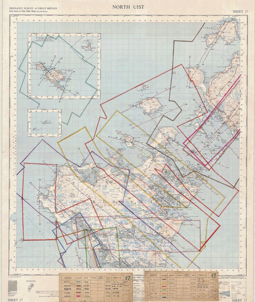
The NCAP Finding Aid in action
These Ordnance Survey Finding Aids show detail you won’t find on Google maps, places that must have a story to tell.
The original documents can be found here and can be viewed through our subscription service along with another 300,000 aerial photographs and 20,000 finding aids of locations around the world.
This post is part of the Explore Your Archive week.