If you were in Edinburgh earlier this year, you may have seen a helicopter criss-crossing its way across Holyrood Park. From it, a laser pulse was mapping the ground below, invisible to the naked eye. The laser was recording the ground’s surface, creating a 3D map of the park. This type of survey is known as LiDAR, or airborne laser scanning.

Take A Second Look
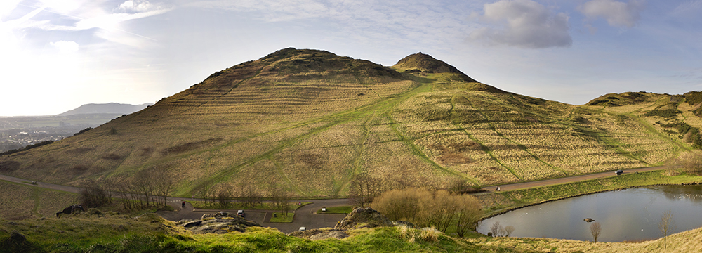
Iconic and ever present on the Edinburgh skyline, the slopes of Arthur’s Seat bear witness to more than just dog walkers and tourists. Archaeological remains stretching all the way back to the Bronze Age can be found – if you know where to look.
These remains are often hidden by vegetation such as the gorse. Some, however, are easily seen such as the cultivation terraces on the east flank of Arthur’s Seat. These ridges were created so the slope of the hill could be used for growing crops. They were used from the Bronze Age into medieval times.
Get To The Chopper
In March 2017 we commissioned an aerial survey using LiDAR to help us find more of the archaeological remains. This would also help us understand the impact of increasing visitor numbers.
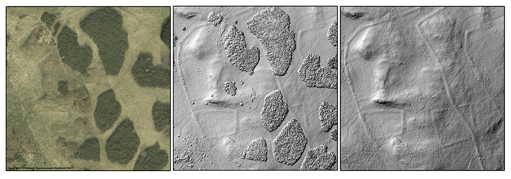
From an initial assessment of the survey data, we’ve made some exciting findings. On the summit of Whinny Hill for instance, we found a number of banks and enclosures hidden by vegetation. Without excavation we don’t know the exact dates of these features, but we suspect they were constructed sometime in the last 400 hundred years so that farmers in the park could manage their animal grazing.
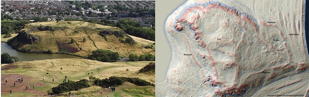
Above Dunsapie car park, the LiDAR data reveals details of an Iron Age fort and settlement. This is most likely a prehistoric farmstead on the crag of Dunsapie.
We’ve known about the fort since the 1940s but the data allows us to clearly see the ramparts built to protect the top of the crag. Inside, we know very little about what it was used for, but other banks show how the area was divided up. On the eastern side, the data shows us the remains of two sub-circular buildings. One is probably a house, with cultivation visible outside the rampart.
We See You
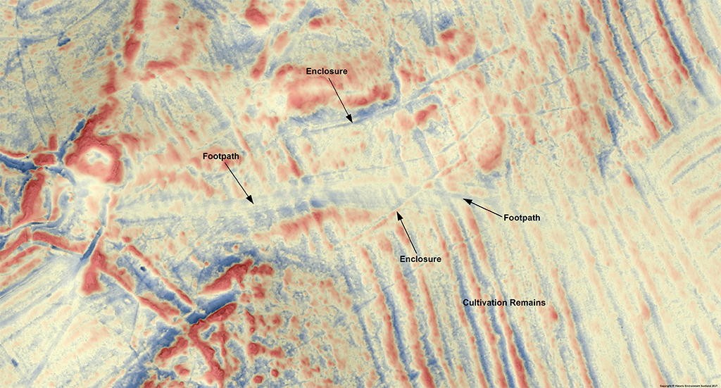
In other places, the impact of visitors on the archaeological remains can clearly be seen in the LiDAR data. In the image below, we can see the main footpath up to Arthur’s Seat as a linear depression crossing the cultivation remains and an enclosure.
The thousands of people who use the path every year have worn down the archaeological remains. This has big implications for managing the heritage of the park.
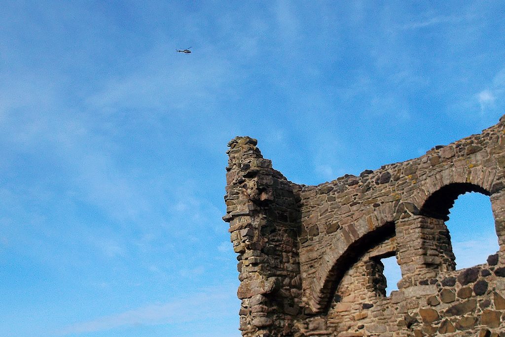
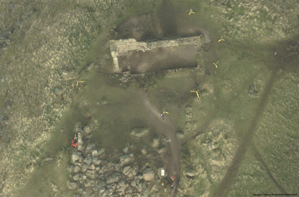
In a rather fitting manner, the LiDAR survey also captured our Digital Documentation Team, who were carrying out a laser scan of St. Anthony’s Chapel.
Don’t Forget About Rae
This terrestrial laser scan is part of the Rae Project, our programme to record all the structures and sites across the Historic Environment Scotland estate. We used laser scanners mounted on tripods to scan around the Chapel, creating a high resolution 3D model. You can find out more about the work in this blog post by Sofia Antonopoulou.
The LiDAR data will be used to inform our management of the Park and to monitor erosion.
This new data has already demonstrated that beneath the gorse, there is much more than meets the eye. We also hope to use the data in more innovative ways, to improve both the visitor experience and our understanding of Holyrood Park.
Which of Scotland’s historic places would you like to learn more about? Leave us a comment, or get involved with the conversation on social media this Heritage Awareness Day using #HeritageDay17.