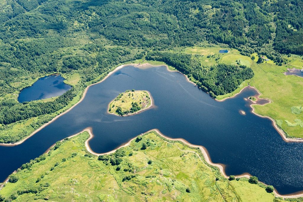
Set in Loch Shiel among the area of Scotland known as the ‘rough bounds’, St Finan’s Isle (or Eilean Fhianain in Gaelic) is framed by mountains, and encircled by eagles from a nearby cliff eyrie.
The island stood at the heart of the medieval parish of Sunart, and acted as the burial place for the Macdonalds of Castle Tioram. Much lay to be discovered during our recent archaeological survey.
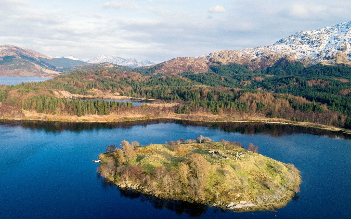
An eagle’s eye view
A dense archaeological landscape
We recorded the island at the invitation of members of the Moidart Historical Group. For us the challenge was both technical – with some 700 features to record – and interpretative. Would we be able to tease out the story of how the landscape had changed over time?
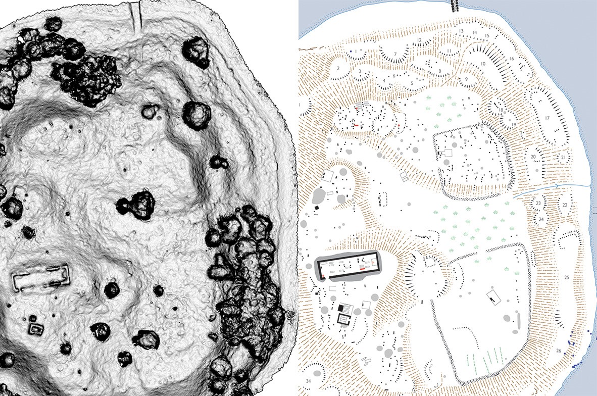
3D visualisation (left) and interpretative drawing (right)
Early Christians
The oldest features on the island include an early medieval hand-bell. This is of a particular type found in Scotland and Ireland, perhaps brought here by St Finan himself more than a thousand years ago.
The bell was stolen by a party of soldiers in the 18th century. A chase ensued and the chief delinquent was ‘tied to a tree and soundly flogged’!
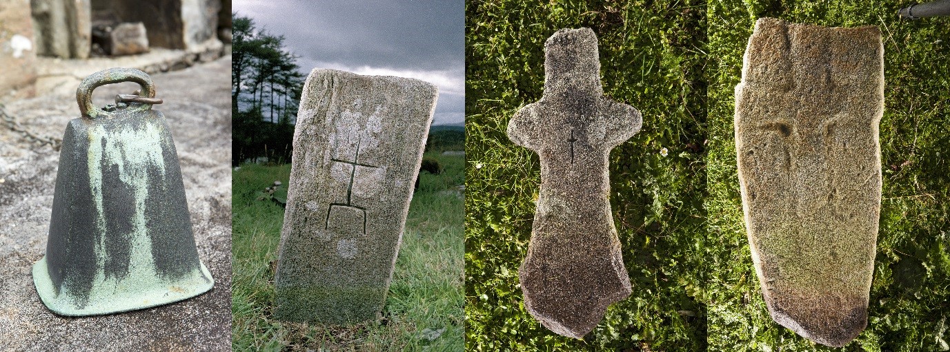
The bell and cross marked stones date to a time when Christianity was a novel belief system
A church restored
The church itself has long lost the fittings of a parish centre, but members of the history society have found a small group of sandstone fragments which show its former status.
These pieces, along with documentary evidence and the character of the surviving stonework, suggest the church was built in the 13th or 14th century.
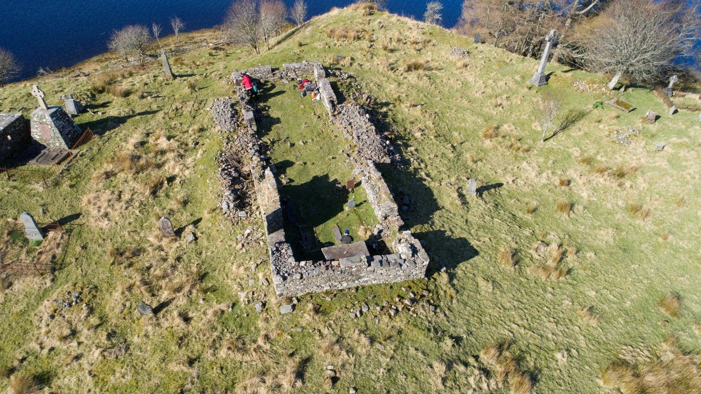
The restoration of the ruin created a Romantic and idyllic scene
Some of the finest late medieval stones on the island probably record the burials of the clan chiefs, their wives and senior family members. Sadly we can no longer read the early inscriptions.
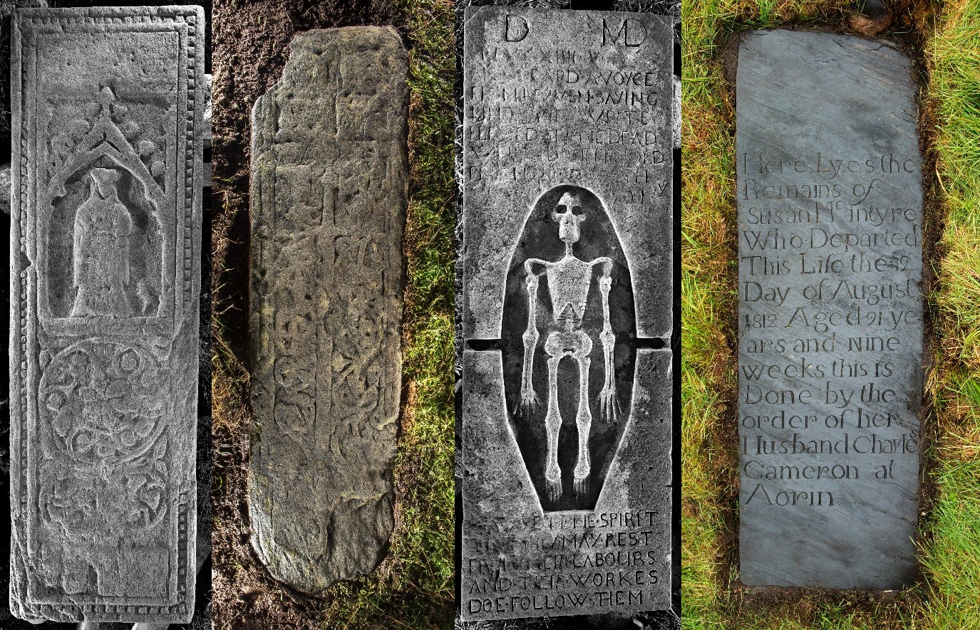
Carefully made grave slabs date from the 15th century (left) to 1812 (right)
Settlement and smithy
Our trickiest challenge included around 40 platforms set into the sides, and a large amount of iron slag. How might these be interpreted?
Some platforms are recent cuttings, made to provide a space for burials. Others have been borrow pits, providing the extra soil needed for continuing burial.
Yet others are building platforms. Documents tell us the minister and a blacksmith lived here in the 17th and 18th centuries. That might explain the quantities of iron slag, which are concentrated on the other side of the island from the buildings.
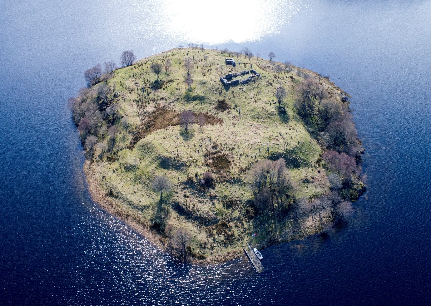
Building platforms can be seen along the island’s coast
You can visit Eilean Fhianain by boat at any time of year, and trips pass the island in the summer months. Be careful though, strong winds scour the glen from time to time…!
If you’d like to learn more about the site, just head to Canmore and search for ‘Eilean Fhianain’.

