Happy GIS Day 2019! Today we’re taking part in an international celebration of geographic information systems (GIS) technology.
In this blog, GIS Service Developer Andreas Buchholz introduces us to GIS and its varied roles from caring for our historic environment to assisting with disaster responses worldwide.
What is GIS?
A Geographic Information System allows us to ask the question about where things are. It can answer questions about who is doing what, where, when and how.
A GIS allows us to plot these answers onto a digital map. This visualisation and analysis can happen on global, national or local level and enables leaders, managers and technicians to make decisions based on facts and figures, sometimes even in real time.
GIS and the historic environment
At Historic Environment Scotland (HES) we use GIS as a decision-making tool. It helps us to answer the important questions about ‘where’ things are in the historic environment and plays a valuable role in our climate change risk assessment.
The GIS Service at HES is based in the IT Development Team at Longmore House, our Edinburgh headquarters. It allows us to update, maintain and publish our geographical information.
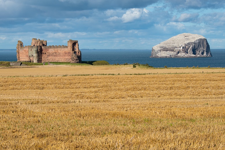
GIS has helped us to complete climate change risk assessments at historic monuments such as Tantallon Castle
This information includes listed buildings, scheduled monuments, and the National Record of the Historic Environment. We publish this directly and through web applications such as Pastmap, Canmore and the Historic Environment Portal.
We also manage the infrastructure that supports web services and allows spatial data to be published.
Volunteering with MapAction
MapAction is a humanitarian mapping charity that works with skilled volunteers to help target and coordinate the delivery of humanitarian aid. Since its inception in 2003, it has responded to over 100 sudden-onset humanitarian emergencies around the world, including the Boxing Day Tsunami (2004), the Nepal earthquakes (2015), the Ebola outbreak (2014) and Cyclone Idai (2019).
It also helps governments and disaster management organisations around the world use geographic information to prepare for disasters before they happen.
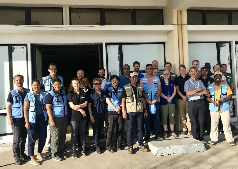
MapAction as part of the United Nations Disaster Assessment and Coordination team (UNDAC) in Beira, Mozambique
Three members of HES staff with GIS backgrounds (Alistair Wilkie, Andreas Buchholz and Mark Gillick) currently volunteer internationally with MapAction.
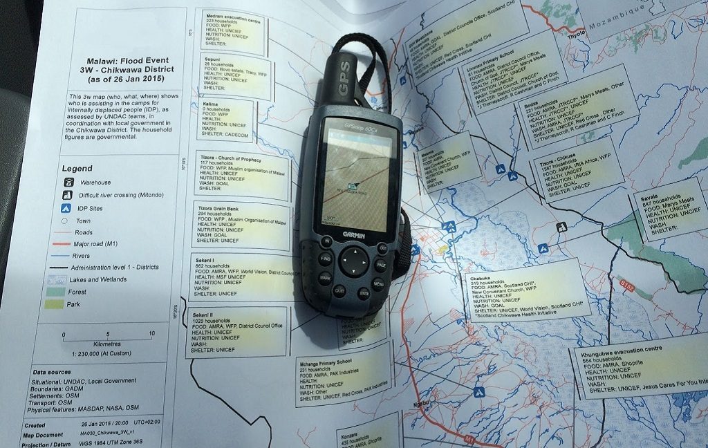
Alistair and Andreas deployed to southern Malawi in 2015 after a flooding disaster. They mapped the needs of affected communities in order to make the responses as targeted and effective as possible.
Andreas deployed with a three-person MapAction team to Mozambique in March 2019 helping with the response to Cyclone Idai. The team was working closely with the government of Mozambique, the UN, the Red Cross and teams from other charities and aid agencies at the heart of the response.
Mark received the MapAction volunteer of the year award 2018 for deploying a remarkable seven times in a single year!
Rapid response
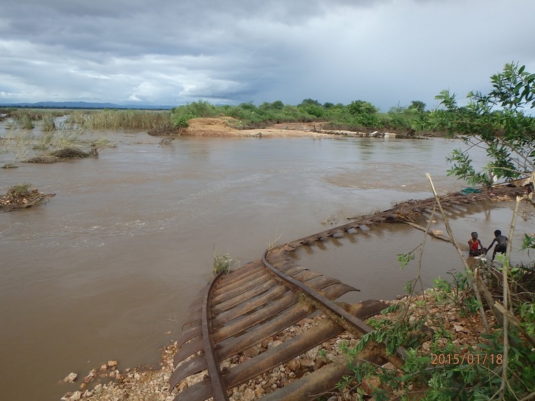
Damaged train tracks near Bangula, Malawi
Humanitarian emergencies often strike without warning, destroying lives and livelihoods within a matter of seconds. In the immediate aftermath, the challenge for those responding is to know where to start.
Which area has been worst affected? Where are the most vulnerable people? What has happened to roads, railways and communication networks? Where are medical supplies and where are they needed most?
MapAction quickly gathers this crucial data at the disaster scene, conveying it visually in the form of maps. By creating this ‘shared operational picture’ for aid agencies, governments and local partners, we can help them make informed decisions and deliver aid and emergency supplies to the right place, quickly.
Championing GIS
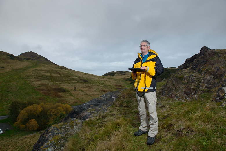
Dave Cowley, Aerial Survey Projects Manager, in Holyrood Park, using a GIS mapping system on an iPad.
The GIS Service at Longmore House currently supports over 200 users in the management of GIS software, services and spatial data – but we’re aiming for more!
Over the past year, we’ve established a GIS Champions team within HES. Volunteers from across the organisation are busy championing GIS and helping to introduce new users to the system.
Who knows, we might be able to produce another MapAction volunteer of the year?!
Want to know more about how we use digital technology at HES? On a previous blog we’ve been Getting Spatial with Archaeological Data