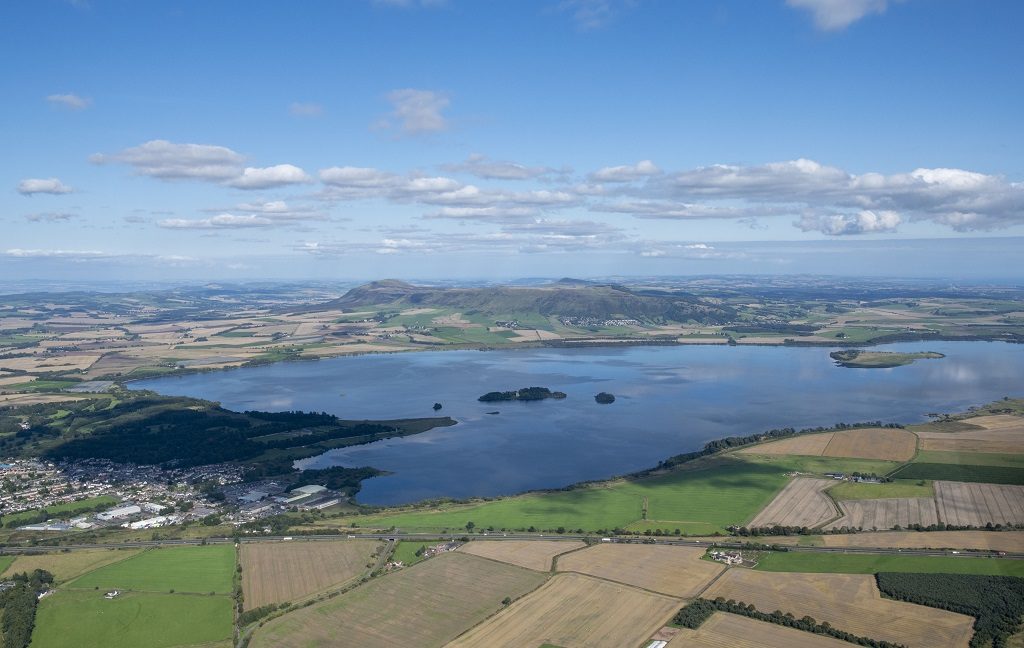
You might think that this view across Loch Leven has been the same for centuries. But a closer look reveals that Scottish landscapes like this one are changing.
This could be due to the effects of climate change, the development of new housing or infrastructure, altering land use or simply the passage of time.
Whatever the reason, these changes impact Scotland’s heritage and natural history, as well as its nature. That’s why we’ve joined forces with NatureScot to monitor selected landscapes across Scotland to see how they are changing.
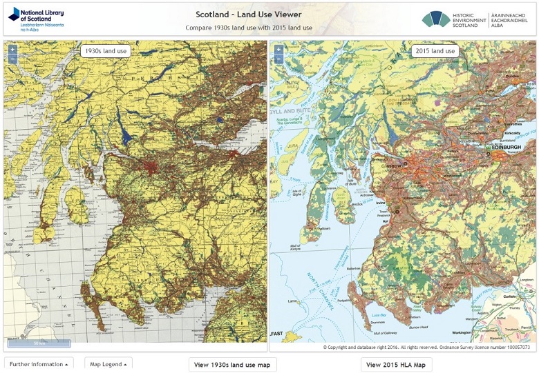
A land use viewer produced in partnership with the National Library of Scotland shows how in the 1930s there were only relatively small areas of forestry but by 2015 large sections of southern and western Scotland were covered in trees
The power of photos
One powerful method for monitoring change is through photography. Photographs can be taken from the same location over a period of time and then compared to assess change.
The National Record of the Historic Environment already holds large numbers of photographs spanning a period of more than a century, many taken from the air.
Aerial photographs give us a unique, ‘birds eye’ view. They have the potential to take in lots of different elements in the landscape at once. We see patterns that would be more difficult to make sense of from the ground.
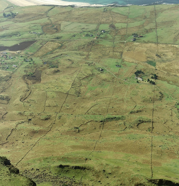
Our “eye in the sky” shows how changing farming practice has left its trace on the landscape. At Cleadale, Eigg, irregular ‘globular’ fields from the 18th century or earlier are overlain by crofting strips laid out in the 19th century
Photographs taken from the ground provide a different perspective, giving us the texture and detail of the landscape.
They can show, for example, the growth and development of vegetation as well as human-made changes within the landscape. We can use them to trace alterations to towns and villages or the development of building styles.
-
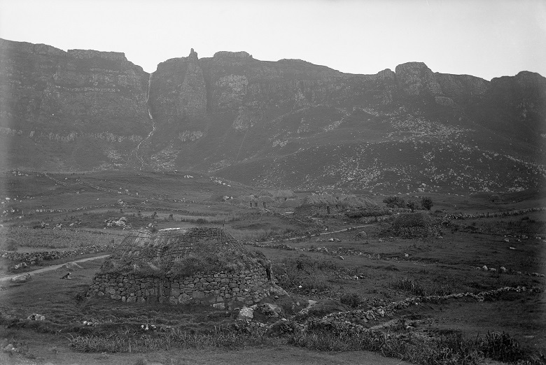
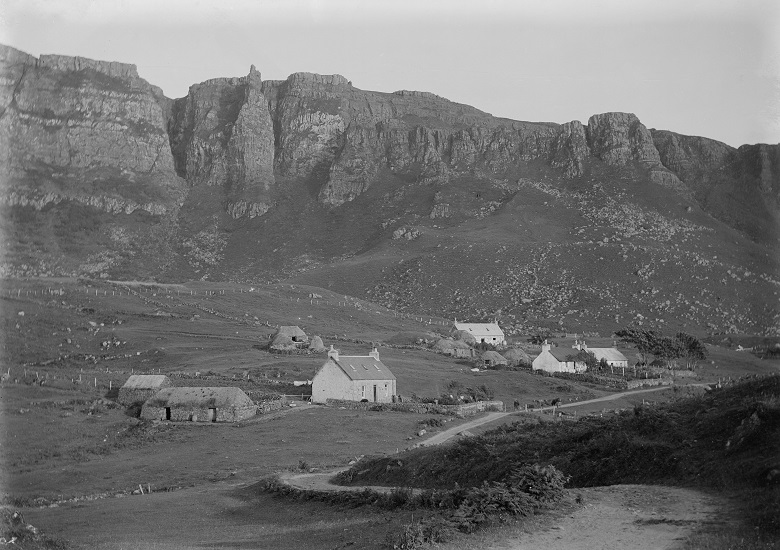
This photo from 1883 shows thatched dwelling houses at Cleadale, Eigg (Courtesy of HES Erskine Beveridge Collection)
-
By 1913, when this photo was taken, new houses with whitewashed walls, slate roof and chimney stacks in both gables are being built alongside the old. The earlier thatched dwelling houses had been turned over to barns (Courtesy of HES)
A starting point
Over the years both HES and NatureScot have mapped many elements of the Scottish landscape.
The landscape character assessment developed by NatureScot identifies and describes the character of the differing landscapes across Scotland. Meanwhile, HES’ historic land use assessment maps the surviving remains of past land use within the present landscape. Both are freely available for anyone to explore.
Together with the historic photographs, they form our starting point. What we want to know now is, what has changed since these maps were created and the photos were snapped? What is likely to change in the future?
What are we doing?
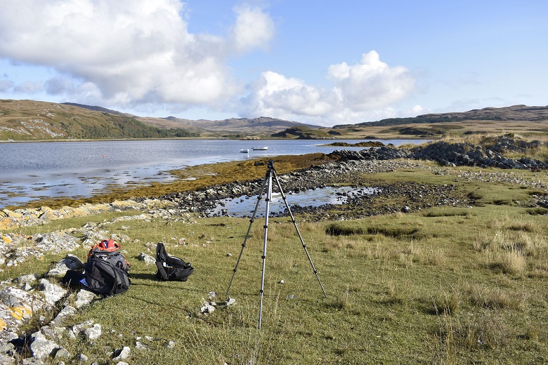
A landscape monitoring point, Inner Loch Tarbet (Creative Commons)
To begin to do this HES and NatureScot are developing a photographic landscape monitoring programme.
NatureScot are developing a network of ground based photographic locations, starting in Scotland’s National Scenic Areas. Each viewpoint will be revisited approximately every 10 years. The sequence of photographs taken will then form a valuable record of the kinds of changes that have taken place in each location.
At HES we are adding the aerial element. We have an established aerial survey programme which has been running since 1976. So, we’ll be taking to the clouds to add aerial shots to complement the ground-based photography. We’ll be able to provide a different, wider view, as well as photographing locations that are difficult to reach on foot. All the photographs, from both sources, will be stored and made available through our online archive.
-
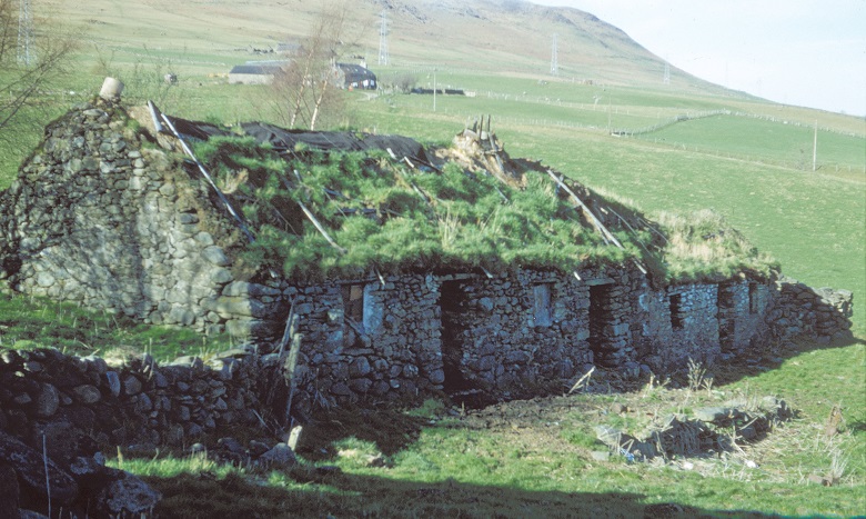
The first of a series of photographs showing the decay of Cuiltrannich Cruck Framed Cottage on the slopes of Ben Lawers, taken in 1966. (Courtesy of HES)
-
By 1976, much of the cottage’s roof had disappeared and the vegetation had grown thicker (Courtesy of HES Horace Fairhurst Collection)
-
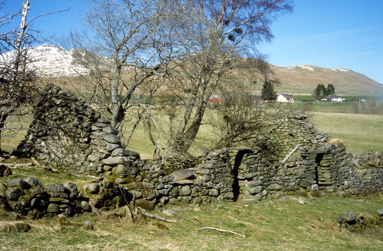
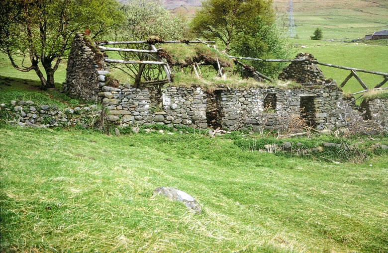
…by 2000, trees had grown up about the cottage and the pylons just visible in the background of the previous pictures had been removed (Courtesy of HES)
But this is not all we are doing…
To help us better understand landscape change at a Scotland-wide level, we’re in the very early stages of developing a comprehensive, automated, nationwide monitoring programme using satellite and remote sensing data.

An aerial view of Ben More and Loch Lubhair, Perthshire
As Scotland’s landscapes continue to evolve and develop, and the effects of climate change continue to be felt, photography and other remote sensed data are important tools. They help us understand, visualise and communicate this change.
By working together, HES and NatureScot hope to find more effective ways of understanding and recording our landscape so that its heritage and natural history is better appreciated, recorded and protected for future generations.
Thanks to Mike Middleton (HES) and Laura Campbell (NatureScot) for their assistance in writing this blog.