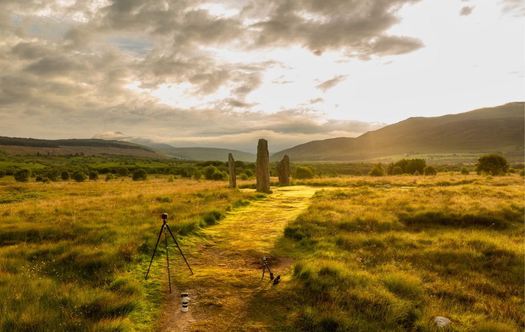
Machrie Moor is one of Scotland’s most captivating prehistoric landscapes. Set within a natural amphitheatre on the Isle of Arran, its mysterious standing stones and cairns have drawn visitors, researchers and local communities for generations.
What we see above the ground on Machrie Moor today only hints at the full extent of human activity this special place has witnessed over the millennia.
In June 2026, we were thrilled to share an exciting new discovery at Machrie Moor. Our archaeologists had found evidence of a previously unknown prehistoric circle, identified through geophysical survey beneath the surface of the moor. Although not visible on the ground, the newly identified monument, known as Machrie 12, appears to be the largest circle yet discovered at the site.
For Ask an Archaeologist Day, we invited people to put their questions about Machrie Moor to our experts. From hidden archaeology and ancient farming practices to landscape alignments and stone circles, the questions explor both the latest findings and some of the site’s enduring mysteries.
Read on as our colleagues Nick Hannon, Senior Heritage Recording Manager (Geophysical Survey), and Stefan North-Sagrott, Senior Cultural Resources Advisor, share their answers and insights into one of Scotland’s most fascinating prehistoric landscapes.
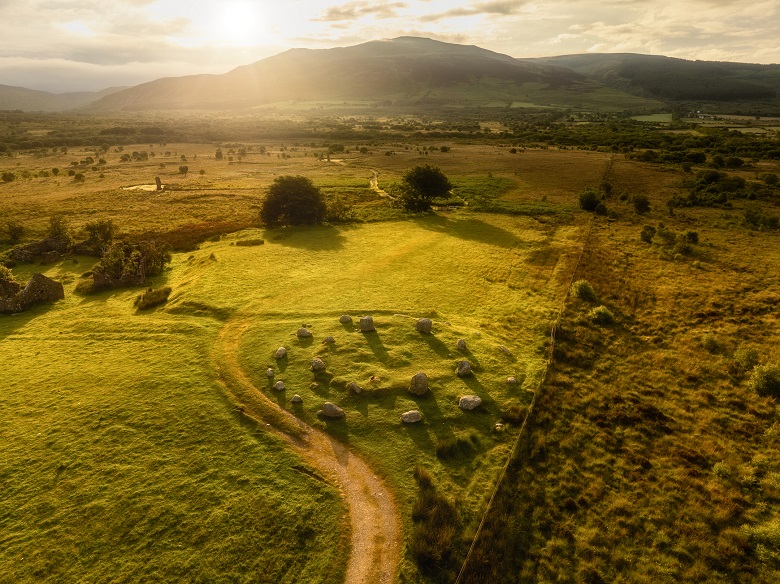
A view of monuments on Machrie Moor, with Circle 5 in the foreground and circles 2, 3 and 4 visible in the background. Image credit: Lee Howard.
Why did you decide to explore this specific area in Machrie Moor?
There were two main reasons for the survey. First, visitors were regularly walking between Circles 2 and 3, where there are no formal paths. This was creating informal tracks and wearing away the peat. We wanted to find out whether any archaeology lay beneath the surface so it could be protected.
The second reason was to test our survey methods. Geophysics has traditionally been thought to work poorly in peatland environments. Machrie Moor gave us an opportunity to try different approaches and see which techniques produced the best results.
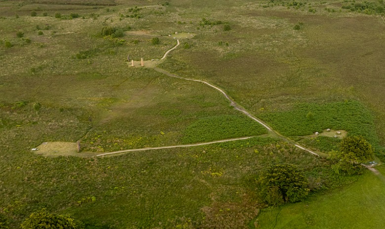
The “new” circle sits between circles 2 and 3, where a faint “desire line” can be seen between the monuments on the left. Image credit: Lee Howard.
Did you know fairly instantly that you had found something while you were carrying out the survey or does it take a while to interpret the results?
No, the instruments we use do not show us the results instantly. We have to download the data from the equipment and then process this when we are back at our desks. Once it has been processed, we then interpret the data, this is when we saw the new circle for the first time.
What effect does adverse weather have on the accuracy of non-invasive techniques like geophysics?
The term geophysics covers a range of survey techniques. Some of these techniques are affected by local weather conditions. For example, Earth Resistance survey passes a low voltage electric current through the ground, this doesn’t work if it is especially wet or dry.
However, the technique we used at Machrie Moor was Gradiometry. This is not normally affected by the weather as it measures the Earth’s magnetic field. The only real exception is during a thunderstorm. We wouldn’t send our survey teams out in those conditions, both for their safety and, frankly, their comfort!
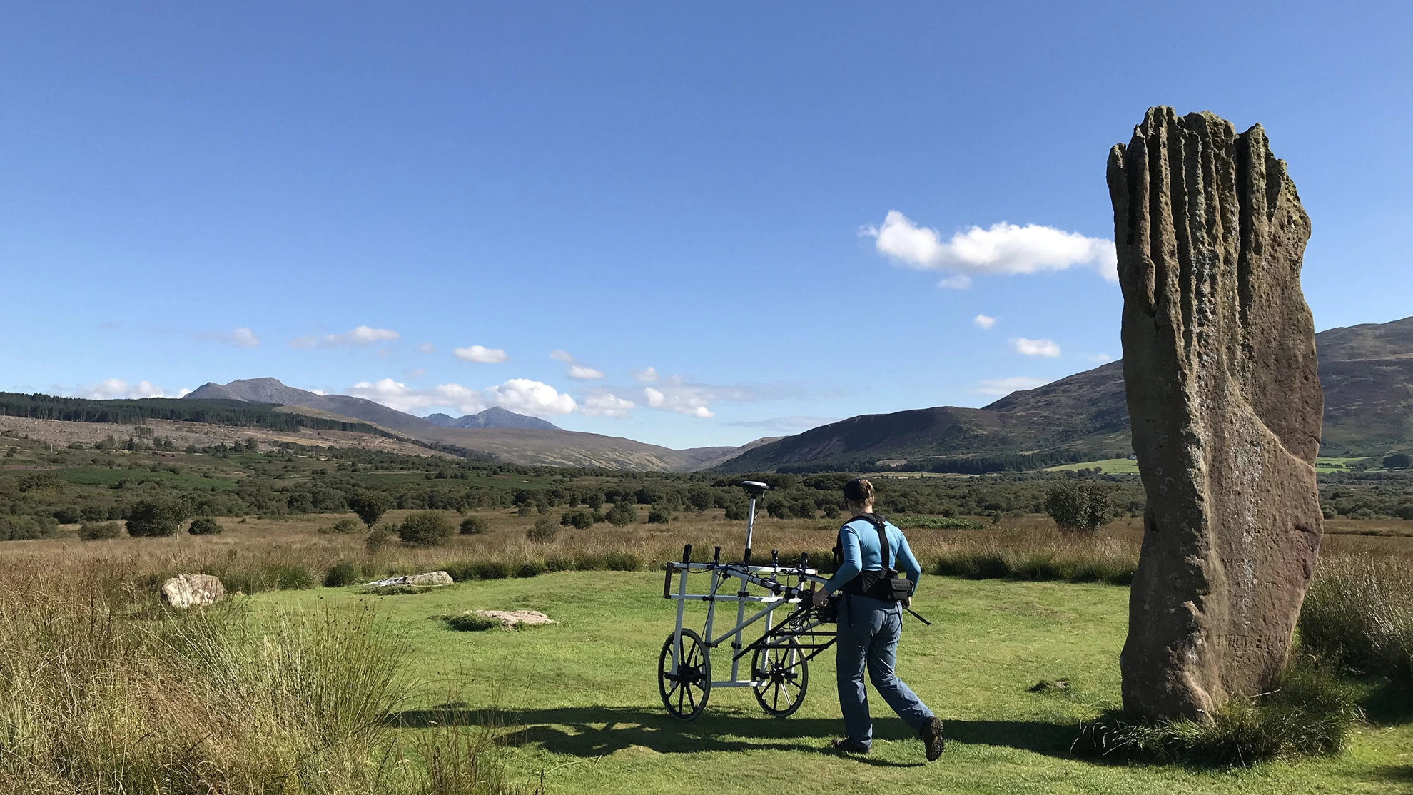
Dr Hazel Blake using Gradiometry equipment beside Circle 3.
What size is the new circle and how does it compare to the circles around it?
The new circle measures 28m by 25m so is slightly ovoid, which isn’t unusual for stone circles. This would make it the largest known circle at Machrie Moor.
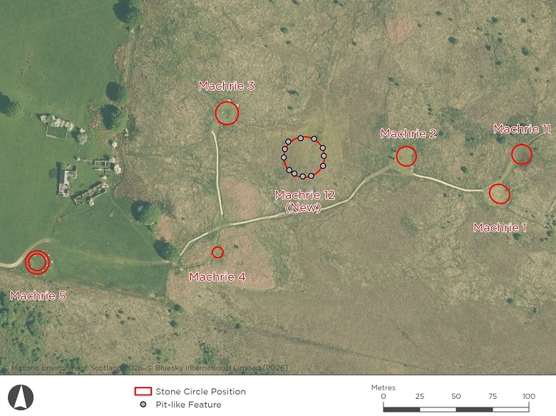
A diagram showing the “new” circle in relation to known features on Machrie Moor.
What evidence is there from across different time periods and/or different types of human activity around the stones?
Full question: I’m always interested if there’s any sign of how human life has interacted with these almost-permanent and quite mysterious structures indicating how or if they fitted in to life, from place of worship to somewhere to keep out of the wind. What evidence is there from across different time periods and/or different types of human activity around the stones?
Machrie Moor has an extraordinary history that stretches back thousands of years. Evidence from the landscape shows people were active here as early as the Mesolithic period. Around 7,800 BC, hunter-gatherers began clearing parts of the woodland through controlled burning.
By the Neolithic period, people were farming the land, growing some cereals and keeping livestock. This period also saw the earliest known ritual activity at Machrie Moor, including pits dug where Circle 11 now stands. Later, timber circles were erected and the wider landscape was organised with fields, suggested by the discovery of postholes and stakeholes.
Around 2,000 BC, the famous stone circles were built. Interestingly, this coincides with reduced evidence for farming activity, suggesting the area may have become a more important ceremonial or sacred landscape.
During the Bronze Age, farming returned on a larger scale. People built roundhouses nearby and reused some of the earlier monuments for burial activity. Over time, deteriorating soils and the spread of peat transformed the landscape, eventually covering and preserving many archaeological remains.
Evidence of later activity can also be seen. The surrounding land has been farmed in more recent centuries, while at Machrie 2 there are stones that appear to have been worked into millstones during the post-medieval period.
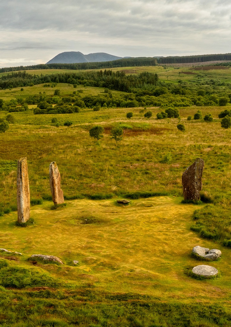
Circle 2, with two partially worked mill stones, which may have been made from a former standing stone.
Today, people continue to visit Machrie Moor for many different reasons. The monuments remain an important part of Arran’s landscape and continue to inspire curiosity and connection.
Why did people select this spot for their monuments?
Full question: I was there yesterday in bright light and saw quite a few cup marked stones, also what looked like a massive mill stone in two parts. Some of the tops of the taller stones appear to connect with the hills behind including Goat Fell, an extinct volcano! It certainly is an interesting area, and makes me wonder why they selected this particular spot.
We can never know exactly why prehistoric people chose Machrie Moor, but the landscape offers some important clues.
When the first Mesolithic people arrived on Arran, the area was covered by mixed woodland, with hazel forming a major part of the landscape. Over thousands of years, the communities living here cleared the woodlands, creating space for farming and livestock.
Machrie Moor is one of the largest expanses of agricultural land on Arran, and people clearly made use of this landscape for thousands of years. The earliest evidence for ritual activity appears alongside this farming activity, showing that daily life and ceremonial practices were closely connected.
The setting itself is also striking. The stone circles sit within a natural bowl in the landscape and cannot be seen directly from the west. Only as you reach higher ground are the monuments revealed, creating a dramatic sense of arrival. This natural “amphitheatre” may have made the area especially suitable for gatherings, ceremonies and rituals.
Whatever the original reasons, people returned to Machrie Moor for generations. They farmed the land, built monuments, held ceremonies and buried their dead here. That long-term investment suggests the area held deep significance for the communities who lived on Arran.
Are the Machrie Moor stones in view of Cioch na h-Oighe (Devil’s Punch Bowl) mountain range?
No, the higher ridges of the Goatfell and horseshoe to the south west of Cioch na h-Oighe means that they are not visible from Machrie Moor (which is on the west of Arran).
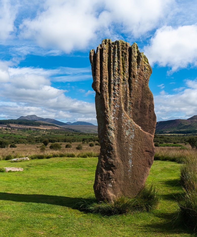
Circle 3 with Beinn Nuis and Goatfell visible on the horizon.
I’d be interested to know whether the alignment conforms with the solar and lunar orientations between the circles which my surveys found 30 years ago?
As Machrie 12 is currently known only through geophysical survey, it’s difficult to assess alignments with certainty. No standing stones or timbers survive to guide us.
It is not generally thought that precise astronomical observation was attempted on Machrie Moor in prehistory. However, studies of the wider landscape suggest several monuments were carefully positioned. From these locations, the midsummer sunrise would have appeared in a prominent notch at the head of Machrie Glen.
It seems very possible that celebrations, rituals and gatherings of people from the surrounding countryside took place at midsummer or thereabouts. The alignment of the midsummer sunrise provides one explanation why so many circles were built here and why the area was used for so long. However, we don’t see the same feature as clearly in other parts of Machrie Moor.
Do we know what relationship Machrie Moor would have had to other sites like Calanais or the Neolithic sites on Orkney?
Each area of Scotland has its own distinctive types of site. These regional variations reflect underlying differences in ancient beliefs, customs and traditions.
However, beginning about 5,000 years ago there are hints of longer distance connections between major ceremonial sites. We can see this in shared architectural features and similar artefacts.
Comparing these sites helps us understand how communities were connected. Some connections may have stretched over long distances.
That said, most people’s day-to-day connections were probably local. Longer-distance links may often have been indirect.
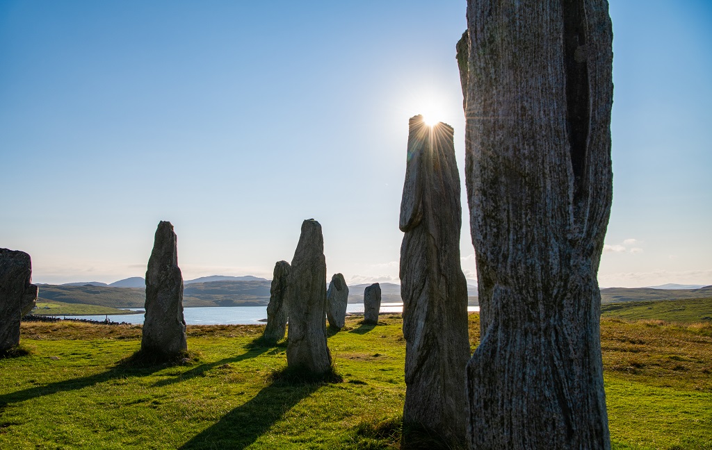
Calanais Standing Stones, Isle of Lewis.
Find out more
Want to know more about how geophysics works? Take a look at Nick’s blog on Dig It!
Keen to hear more about recent discoveries in Scotland? Take a look at this blog by Kirsty Millican.
Banner image: Machrie Moor Circle 2 by Lee Howard.
Share
About Author