Did you know we’re on a mission here at Historic Environment Scotland (HES) to digitally document every place and object in our care? It’s called the Rae Project, and it’s a huge undertaking – but we’re up to the challenge!
Why the Rae Project?
The Rae Project is named in tribute to 19th Century Explorer John Rae. Born in Orkney in 1813, Rae became surgeon of the Hudson’s Bay Company’s ship Prince of Wales and went on to explore the Arctic and Canada. You can read more about him in this article from Orkney Jar.
Our project doesn’t involve travelling quite as far as Rae, but the work does take us all over Scotland. Led by the Digital Documentation Team based at the Engine Shed in Stirling, our aim is to accurately document our properties and collections in 3D, from Jarlshof in Shetland to Kilmartin Glen.
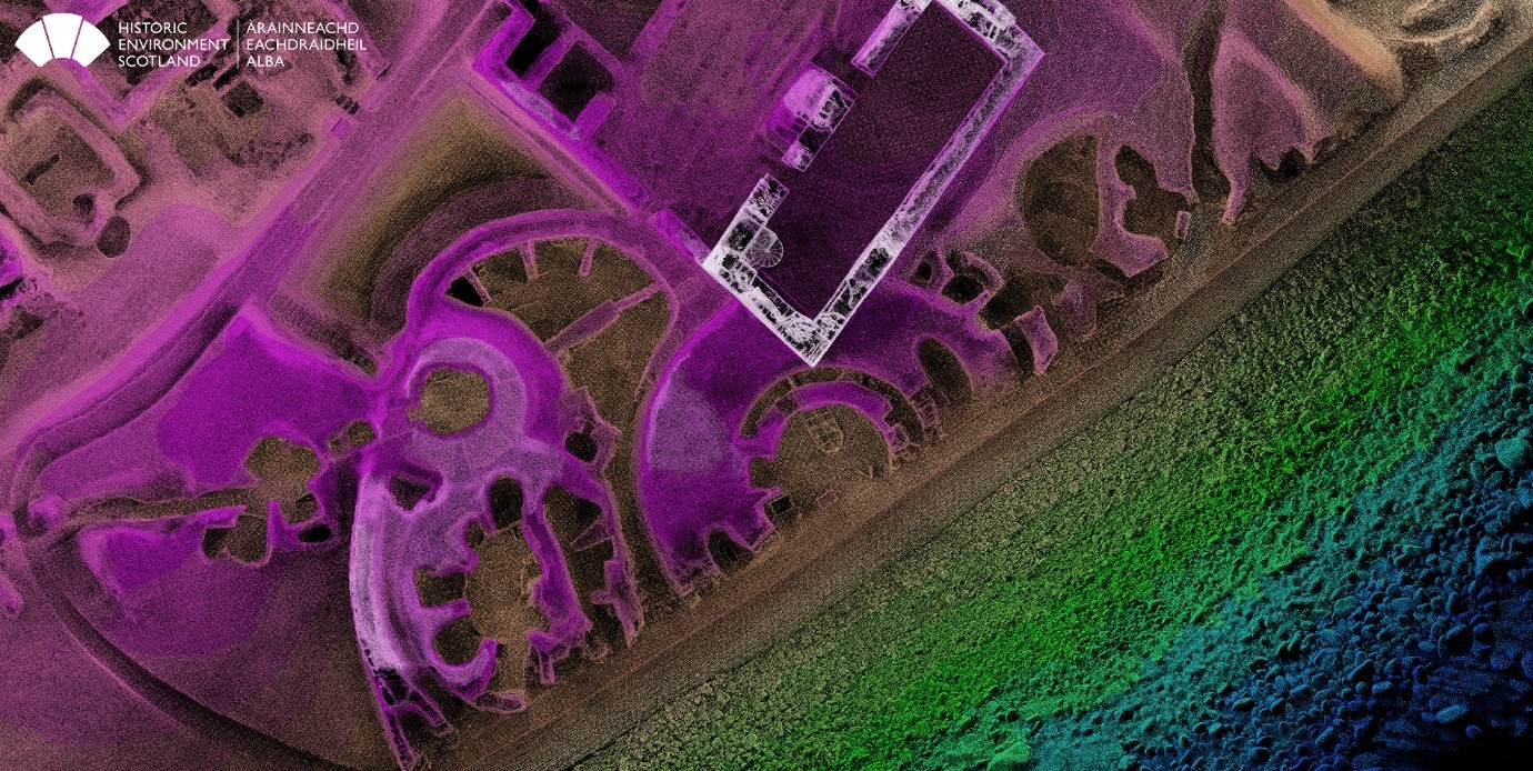
A point cloud plan view of Jarlshof, Shetland. Digitally documented as part of the Rae Project in 2018.
Digitally Documenting Historic Places
At HES we look after 336 historic properties across Scotland, from Dun Carloway Broch to Edinburgh Castle. Digital technologies are absolutely crucial in helping us learn as much as we can about these ancient sites and it’s important to be able to visualise the data. That’s where the Rae Project comes in!
Our aim is to capture accurate, highly detailed and colourised spatial information.
To do this we use laser scanners to scan each site. The scanner captures 3D spatial data (x, y and z coordinates) in the form of a point cloud – millions of 3D points that depict the physical form of the site. These are georeferenced (assigned real-world coordinates) and archived for current and future use.
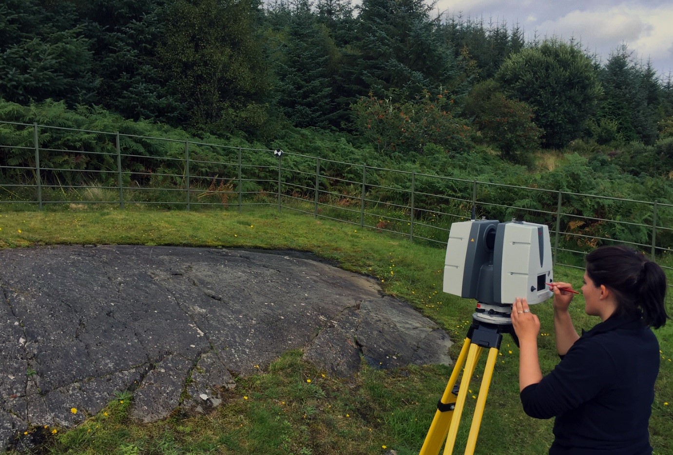
Digital Documentation trainee Bonnie Burton 3D laser scanning Prehistoric Cairnbaan Cup and Ring Marked Rocks in Kilmartin Glen
We then add Digital Photogrammetry (or Structure from Motion) based on photographs taken from the ground. We can also use drone imagery to supplement the datasets. This helps us make sure high level areas like roofs and chimneys are documented. We specify 5mm point spacing on building surfaces, which ensures that stonework and architectural details are captured clearly.
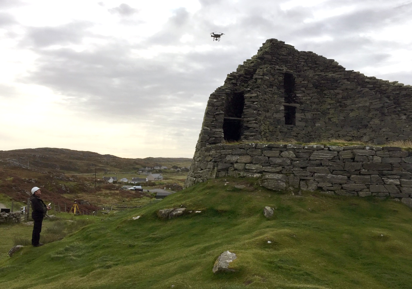
Scott Hamilton, Building Conservation Technologist & Pilot capturing aerial images of Dun Carloway Broch in The Western Isles
So far we’ve managed to digitally document around 40% of our HES sites in 3D.
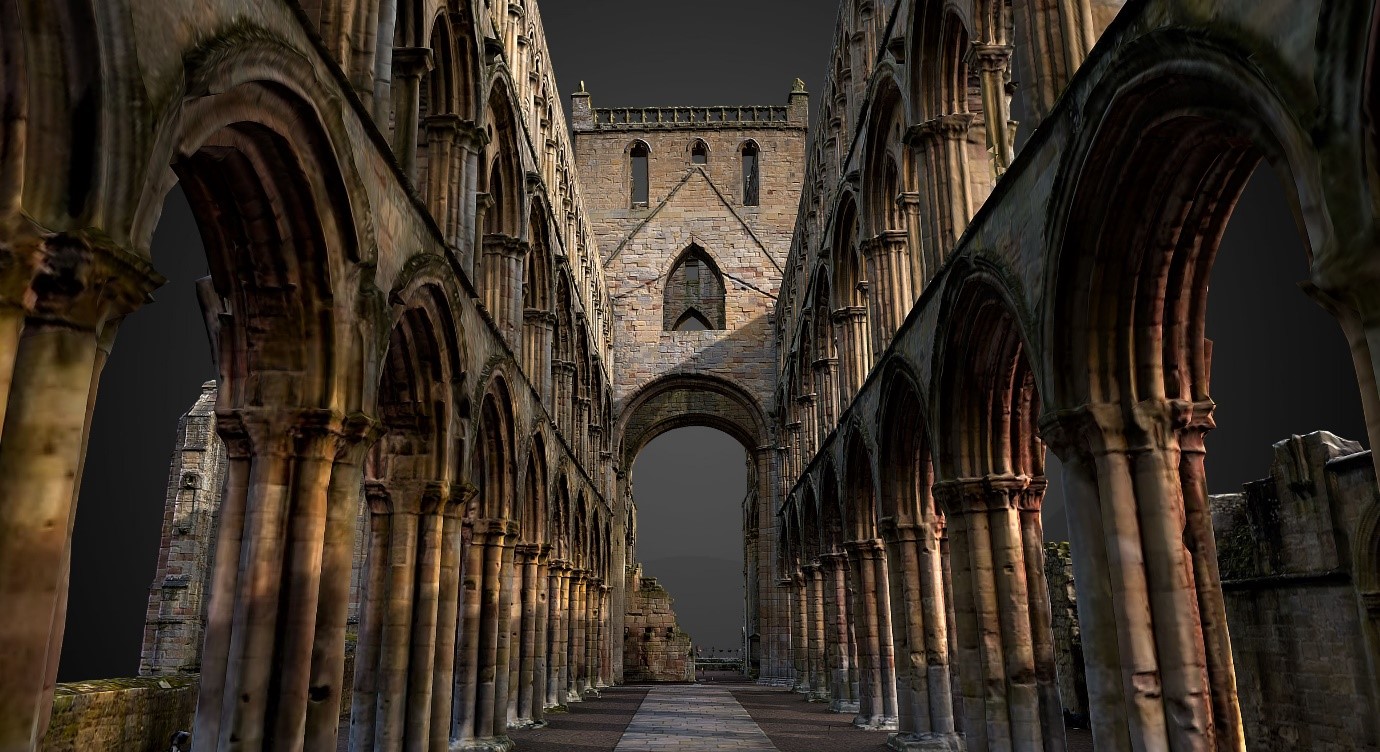
An optimised 3D model of Jedburgh Abbey.
Digitally documenting our Collections
As if scanning Scotland’s abbeys, castles and brochs wasn’t enough work, the Rae project also includes recording more than 38,000 artefacts in our object collections.
There is a huge variety of objects to record, held in different locations and presenting us with some unique challenge in terms of material, size and condition. In addition, sometimes we don’t have control over lighting, the environment or physical access.
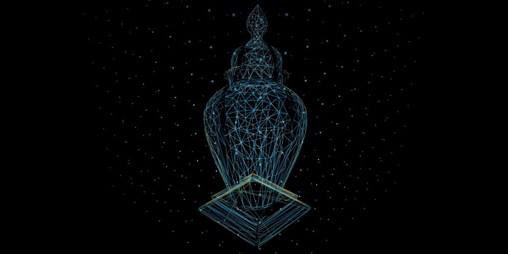
We’ve needed to use a range of technical solutions, including Structured Light Scanning, Close-Range Laser Scanning and Photogrammetry to accurately record the objects. We’ve created some guidance on how to get around some of the common problems – this is now used by our team and external contractors too. This means all the data meets a high standard. It’s also reusable and can be used to improve interpretation content, assist condition assessment and help with salvage planning.
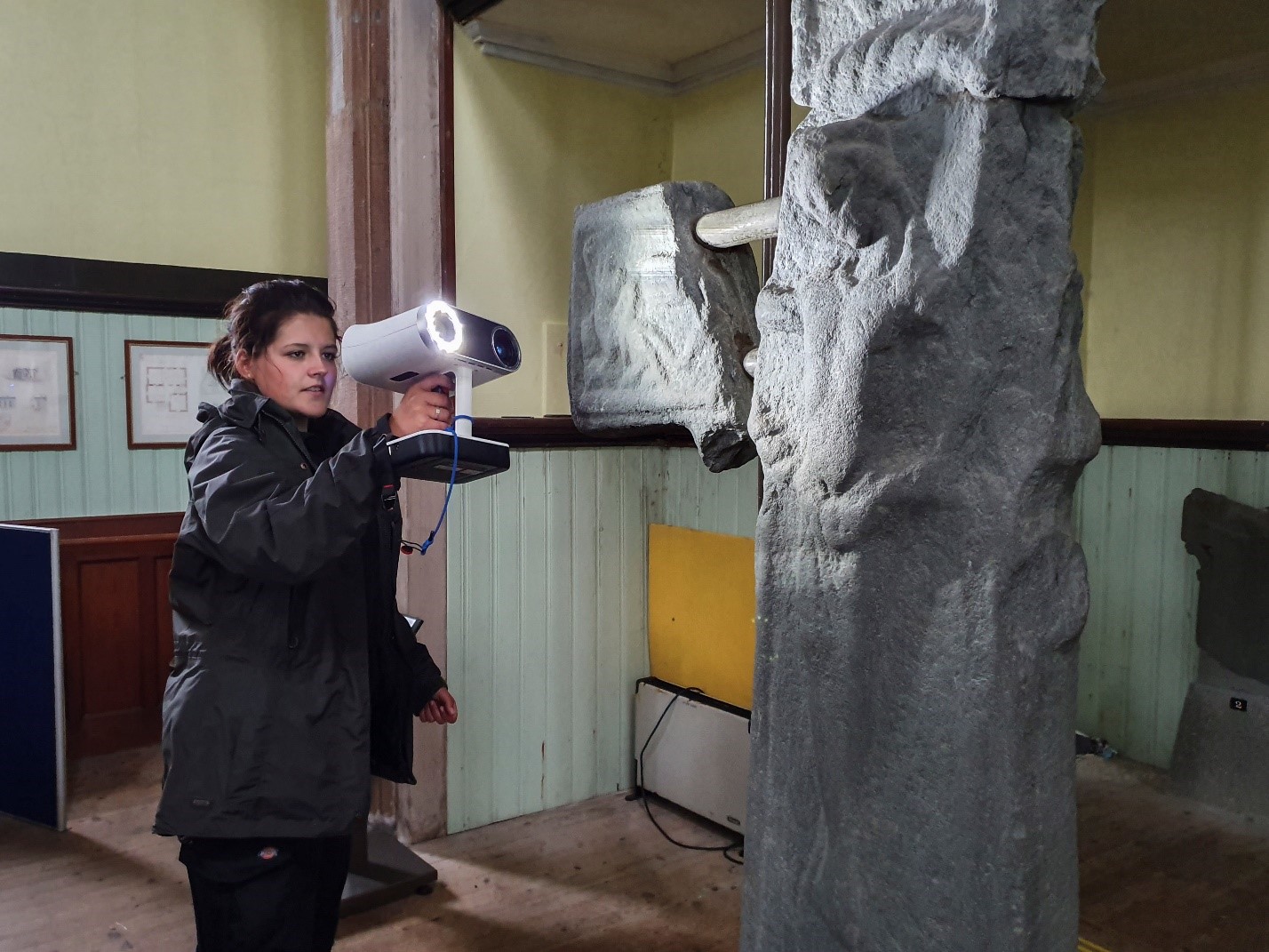
Digital Documentation trainee Bonnie uses structured light scanner at Kilmartin Parish Church
So far we’ve documented over 320 items. Some of our highlights include:
- Grave slabs from Kilmartin Church in the West Highlands
- A red wax seal from the 16th century
- An oak panel depicting the Crucifixion, dating back to the 1530s or 1540s
What do we do with all that data?
One of our biggest challenges is data management. As you can imagine, we have some very big files! As well as needing to store all our raw data, software-specific working files, outputs and deliverables, we have to integrate with other HES databases.
This is because a Rae Project dataset acts as the starting point for all kinds of work undertaken by HES. This includes conservation, monitoring, building information modelling (BIM), learning, accessibility, interpretation and research projects.
Uses of the data include:
- 3D interactive models in gaming environments
- 3D prints developed with our Digital Innovation Team, which enable people to hold exact replicas of very old objects
- 3D point clouds used to assess the condition of objects and buildings
- Collaborative scientific reports with our Conservation Science and Climate Change teams and external partners, such as Dynamic Coast
- Open access publications to share learning, for instance on how to spot (and then address) defects in masonry
We also use Sketchfab to make our 3D models accessible – for instance with this model you can explore Mousa Broch from home. Turn up the sound to listen to the storm petrels which nest in the broch walls!
What’s next?
One of the most exciting aspects of our work is that the digital technologies we use evolve rapidly. We’re constantly on the lookout for tech developments to help us get more efficient and complete the huge task that lies ahead of us. We’ll keep generating even better data to help protect and share our historic environment for everyone to enjoy – so the Rae Project will be going for some time yet!
If you’ve found this interesting, please download our Guide to Applied Digital Documentation in the Historic Environment to find out more about what we do and why we do it.
This post was written by Lyn Wilson, Adam Frost and James Hepher from our Digital Documentation Team.